MAP CONTROLS: Use slider or mousewheel to zoom, and hold down left mouse button
to drag.
KEY: Location markers are coloured from Green meaning exact to Red meaning
gone or unknown (details here)
|
|
Location Category ID:
|
3040
|
|
Added to Database:
|
20 October 2009
|
|
Last Edited:
|
19 February 2012
|
|
Address: |
|
|
Telephone: |
Answer phone (public access information): 01980 674763
|
|
Email: |
|
|
Opening Times: |
|
|
Official Website: |
Salisbury Plain
Access Opportunities
|
|
Other Links: |
Panoramio
Wiltshire Heritage
|
|
Latitude, Longitude: |
51.23239
,
-2.11367
|
|
Location Accuracy: |
7
|
|
Tanks Previously Here: |
1: M4A4 Sherman Tank - Barrell Collection, Bedfield, Suffolk, East England, Britain (Recovered 6 June 1991)
2: A27L Centaur Tank - The Tank Museum - Reserve Collection, Bovington, Dorset, South West England, Britain (Presumed 2008)
3: A11 Matilda I Tank - The Tank Museum - Reserve Collection, Bovington, Dorset, South West England, Britain (Until ca2002)
4: A22 Churchill Tank - Isle of Wight Military History Museum, Cowes, Isle of Wight, South East England, Britain (Recovered 2002)
5: A22 Churchill Tank - Isle of Wight Military History Museum, Cowes, Isle of Wight, South East England, Britain (Recovered 2002)
6: A22 Churchill Crocodile Flame-Throwing Tank - Isle of Wight Military History Museum, Cowes, Isle of Wight, South East England, Britain (Until ca2009)
7: Ram Kangaroo Armoured Personnel Carrier - The Tank Museum - Reserve Collection, Bovington, Dorset, South West England, Britain (Recovered – presumed 1992)
8: Ram Kangaroo Armoured Personnel Carrier - The Tank Museum - Public Areas, Bovington, Dorset, South West England, Britain (Recovered 1985)
|
Salisbury Plain Army Training Estate (ATE SP) is one of the most well known areas of all Ministry of Defence (MOD) land. The Army has been connected with Salisbury Plain since 1897 and the total area of the current estate is just over 38,000 hectares. It is 25 miles by 10 miles (40km by 16km) and occupies about one ninth of the area of Wiltshire. In terms of land use, much of the land is let to farmers or is grazed under licence. Approximately 12,150 hectares of the land is used for live firing and as impact areas. Public access is permanently restricted in certain areas for safety reasons. This includes the Imber Live Firing Area which is closed permanently, although the roads from Gore Cross to Warminster and Bratton to Heytesbury via Imber are opened to the public on a number of days each year. Also, a church service is held in Imber village every September.
|
December 2008
|
| | | |  | | | | |
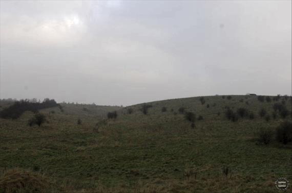
1: Tanks on hilltop near Bowls Barrow, photo taken by Robin...
Taken: 30 December 2008
Contributor: Geograph
Location Photo ID: 166
Added: 20 October 2009
Views: 203
Has Priority: 0
|
|
|
|
| | | |  | | | | |
2: Tank wreck on ridge visible from Imber Road, photo taken...
Taken: 30 December 2008
Contributor: Geograph
Location Photo ID: 167
Added: 20 October 2009
Views: 199
Has Priority: 0
|
|
|
|
|
August 2007
|
| | | |  | | | | |
3: Tank track at Imber Range, photo by Graham Horn
Taken: 25 August 2007
Contributor: Geograph
Location Photo ID: 168
Added: 20 October 2009
Views: 200
Has Priority: 0
|
|
|
|
| | | | 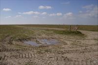 | | | | |
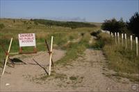
4: Summer Down, Imber Range, photo by Graham Horn
Taken: 25 August 2007
Contributor: Geograph
Location Photo ID: 169
Added: 20 October 2009
Views: 216
Has Priority: 0
|
| | | |
|
|